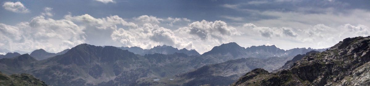
The Haute Randonnée Pyrénéenne is a thru-hike traversing the Pyrenees mountains, a range that defines the border of France and Spain. The result is that one will experience several languages as they proceed along the span of the Iberian Peninsula’s northeast edge.
The HRP takes the hiker across 500 miles (800 km) of mountain landscape from one coast to the other, trying to follow the frontier between the two countries as closely as one can. The route does not have official signs or its own exclusive way-marking (and in some places there is no path at all).
It is a route that admittedly puts your navigational skills to the test. There were many times during my 2017 trek (especially in the deep fog and scree slopes) when I was so incredibly thankful I had the foresight to enter coordinates into a gps, which I faithfully carried in my back pocket. Large scree fields and steep forested slopes make finding each and every paint mark there might be an absolute necessity. But while it is not as popularized or well-known (or as long) as routes like the PCT or AT in the United States., the HRP is unquestionably an experience that will forever imprint your life with its beauty. The Wikipedia page sums it up pretty well, and was a good starting point for my researching of this route.
Having successfully completed the journey, I’d like to designate this place on the internet for info, stats, media and to field questions etc. for others who might consider doing a through hike. I’ve enabled commenting if you’d like to get anything answered. Because I was setting off on this considerable trek on my own, it took a lot of homework and planning (and training), as well as a realistic sense of my capabilities and limitations. That last bit I can’t overemphasize enough. Not having another person to rely upon in remote, harsh and unforgiving landscapes means that having thorough knowledge of the land, weather patterns and resupply locations is a critically advantageous tool. If you travel in foreign countries, you may have to assume total self-sufficiency as an outsider who doesn’t speak the language. On any hike that takes you through remote areas, you must accurately estimate how much ground you can cover in a day. I remember welcoming any small bit of advice for the route, anything that could help clear the shroud of limitations to practical information. So, it is my hope to aid others with what I’ve gathered. I’d like to contribute in some small way to the planning process for future generations of backpackers. It will also prove useful to document everything if I ever am able to do another epic hike.
There’s more to come, so stick around! You can check out the footage I took here:
I’ll start with the main source of inspiration that got me hooked. They did an outstanding trip summary and it really was an excellent starting point for me as I began to seriously consider this trip.
My initial planning process and pack weight. It changed a bit before I actually set out. When I got back I weighed my pack at 35 pounds base weight, still trying to do the numbers and figure out where the phantom pounds were.
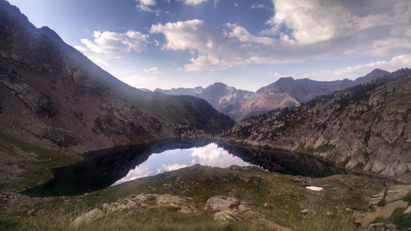
I’ll eventually have a more of everything but here are some photos!
